

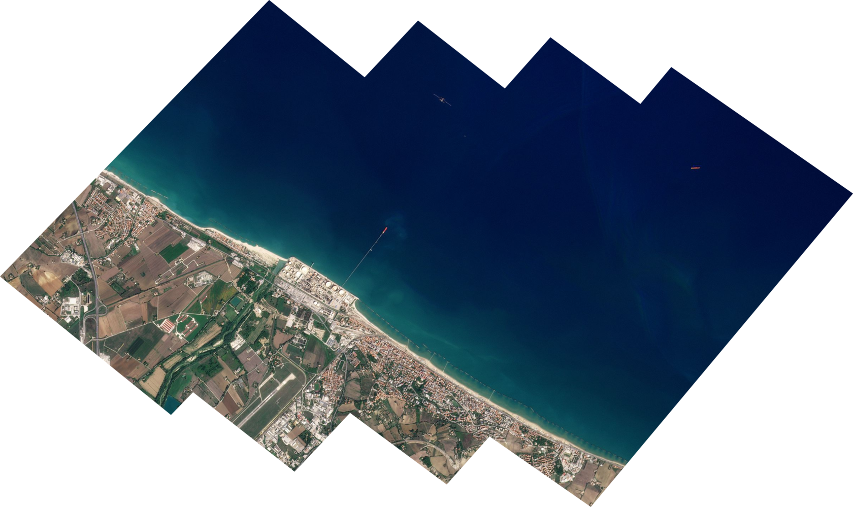


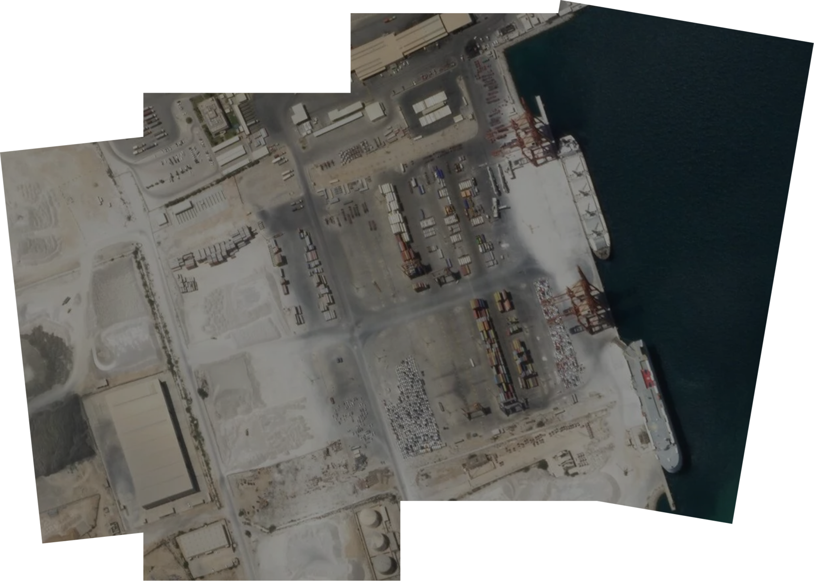
Imagery examples
EarthScanner, 0.5 m resolution
Riyadh, Saudi Arabia, 2021
Sossusvlei, Namibia, 2019
Buenos Aires, Argentina, 2022
GaoFen-2, 0.8 m resolution
JL-1GF04A, 0.3 m resolution
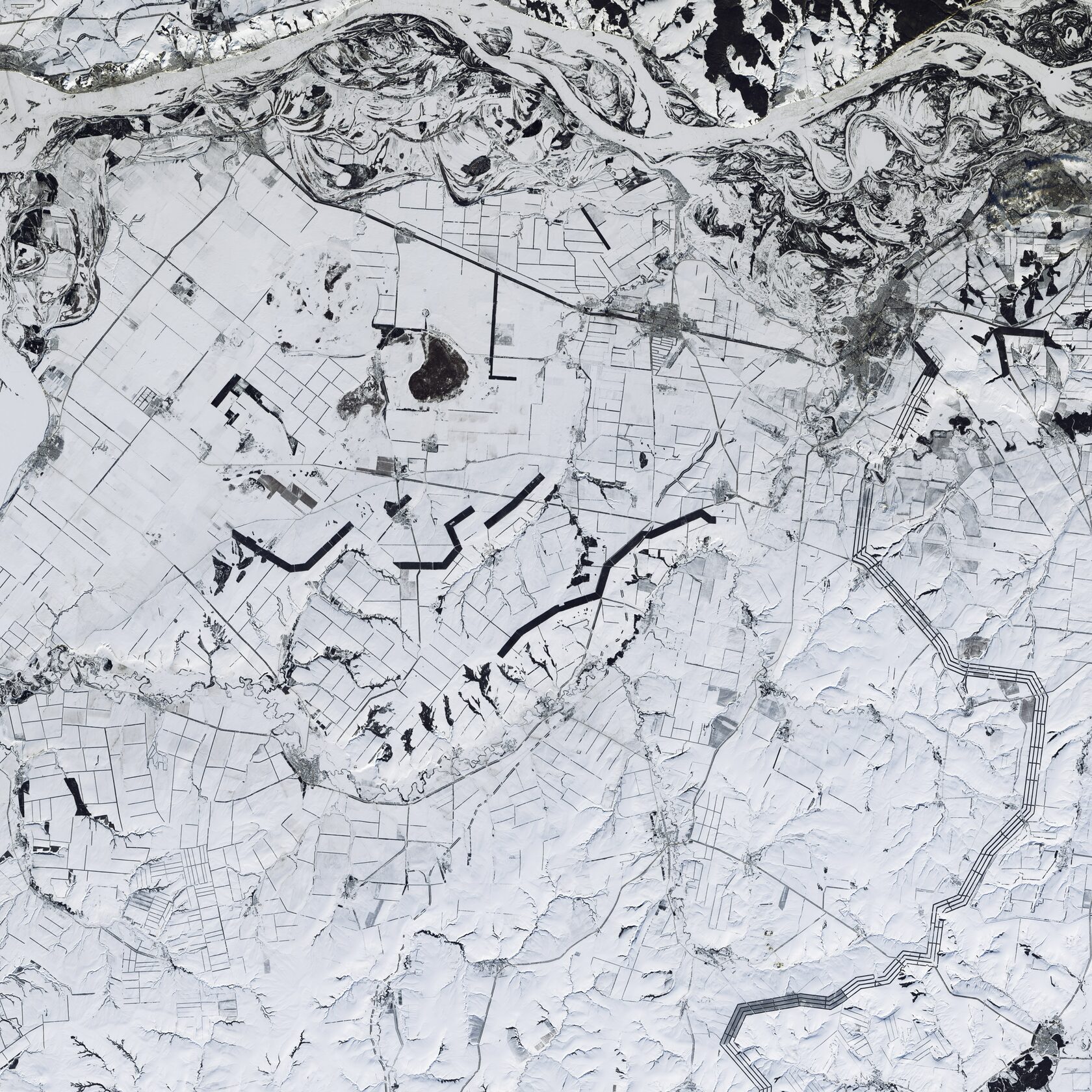
DailyVision, 0.75 m resolution
Copper mines, Chile, 2022
Sossusvlei, Namibia, 2019
West Coast, Australia, 2020
HiSea-1 SAR, 0.5 m resolution
EarthScanner JL-1KF01, 0.5 m resolution
SR DATA

Imagery usage
Geospatial Intelligence
Analysis of the activities of airports, railway stations and logistics companies. Assessments of the warehouse content
Forestry monitoring
Monitoring forest and tracking illegal logging
Analysis of social activities
Military intelligence, the results of military conflicts. Tracking the epidemiological situation. Protection of human rights
Natural disaster prediction and response
Real-time tracking of various natural disasters: fires, floods, landslides, volcanic eruptions
Environmental monitoring
Forecasting the ecological situation. Information on pollution for making control of enterprises
Urban Development
Planning of built-up areas. Management and monitoring of green spaces within cities
Agriculture
Determination of field boundaries and horticulture, crop varieties growing within the field, NDVI analysis
Ice monitoring
Tracking the thickness of ice and its movement within the Northern Sea Route and Arctic sea.
Monitoring of production facilities and investment expertise
Tracking the dynamics of the construction of industrial facilities and assessing investment attractiveness
SR DATA
Ice monitoring
Ice monitoring — constant monitoring of ice thickness in harbors, throughout freezing shipping routes.
It is carried out in order to ensure the safe navigation of vessels, increase the speed of overcoming water areas partially covered with ice, plan escort in ice areas and make passageways through ice.
Our service allows:
It is carried out in order to ensure the safe navigation of vessels, increase the speed of overcoming water areas partially covered with ice, plan escort in ice areas and make passageways through ice.
Our service allows:
- identify ice that poses a potential hazard and determine its parameters: occupied area, geographic coordinates, etc.
- discover large ice channels, cracks, faults, hummocks, fields, polynyas. Estimate their degrading parameters in the initial period of ice melting.
Back
Monitoring of production facilities and investment expertise
Satellite monitoring makes it possible to assess the business activity of organizations and enables informing credit, financial, investment companies engaged in the construction of large complex facilities.
Our service provides analytics about the business activity of companies, which can be used to:
Our service provides analytics about the business activity of companies, which can be used to:
- determining lending rates, insurance rates and investment risks for prompt and objective assessments of the economic activities
- speed up and simplify the work of credit companies in terms of working with land assets, commercial and residential real estate
- control over targeted spending of allocated funds
- reduce operational risks and optimize costs
- improve the quality of management decisions in the field of investment and lending
Back
Agribusiness
The tasks that satellite imagery helps to solve:
- Inventory, accounting and control of land
- Crop monitoring
- Control of unfavorable processes
Back
Geospatial Intelligence
Geospatial Intelligence is the acquisition of human activity data through the use and analysis of images and geospatial information that describes, assesses and visualizes physical objects and geo-related activities.
Such data helps to describe, explain, predict human activity, and analysis results benefit the decision making process.
Back
Forestry monitoring
The main tasks solved by remote sensing include:
- forest mapping
- identification, control and monitoring of illegal logging
- study and mapping of negative processes affecting forest: the impact of pests and diseases, drying up or waterlogging of forests, leading to its degradation and death
- study of natural conditions that impede active legal logging (detection of flat low wetlands, drainage basins, sharp relief inflections, etc.) using digital elevation models
Back
Analysis of social phenomena
Tracking social activities is an integral part of strategic and operational-strategic intelligence, which is a set of measures for obtaining, processing and analyzing information about the state of individual regions, countries, cities, groupings of troops, military installations, geographical regions of the planet, social groups, etc. by using space infrastructure and related ground systems
Among the main functions are the following:
Among the main functions are the following:
- tracking terrorist organizations
- tracking social unrest or protests
- monitoring of forbidden nuclear tests
- detection of missile launches and troop movements
- fixing the migration of people, including refugees
Back
Disaster prediction and response
Space satellites are an indispensable assistant in tracking natural and climatic changes that can trigger natural disasters.
Natural disasters usually include earthquakes, floods, and volcanic eruptions. In some cases, they include forest and peat fires, as well as man-made disasters and accidents in petroleum and chemical industries.
Natural disasters usually include earthquakes, floods, and volcanic eruptions. In some cases, they include forest and peat fires, as well as man-made disasters and accidents in petroleum and chemical industries.
Back
Environmental monitoring
The ecological situation directly affects the quality and conditions of life on the planet. Various environmental disasters and catastrophes can lead to irreparable consequences.
As a result of human activity, such events as the oil spill in the Gulf of Mexico, the man-made disaster at the Chernobyl nuclear power plant, and the ecological crisis on the Kamchatka Peninsula took place. Smaller excesses associated with environmental pollution occur regularly. For example, in late 2008 and early 2009, an oil spill was reported near the city of Bodo in the Niger Delta region of Nigeria. Satellite images were taken to monitor the situation. An image dated December 2006 was used as the basis for subsequent analysis. Those images indicated the relatively minor impact of petrochemical infrastructure in the region. Pictures taken in January 2009 indicate a change in the situation: large areas of vegetation appear dead. Satellite monitoring allows not only to track the situation, but also to build a strategy to solve it.
Among others, the ecological situation also affects the epidemiological situation in the world. The consequences of floods can be outbreaks of diseases such as diarrhea, cholera, typhoid fever and hepatitis. Rising sea levels, coupled with increasingly severe weather, could make flooding a common occurrence across the planet. Also, satellite monitoring helps to monitor the situation with rising sea level, anticipate floods and quickly respond to changing situations.
Back
Urban Development
The use of medium and high-resolution satellite imagery can help developers in decision making and benefit to sustainable development in dense urban environments. The process includes monitoring of changes, which requires high-resolution data to create detailed descriptions for strategic planning related to urban development.
Satellite imagery analysis allows creation of periodically updated GIS maps and detection of major changes in urban land cover and land use. That enables clients to classify green and sustainable areas and suggests areas for development by frequently analyzing time series.
The rapid development and growth of urban areas is putting increased pressure on the environment, including city parks and green spaces. Green spaces, including streetscapes, lawns, public parks, gardens, crops, and forests, are essential not only to give the appearance of urban areas, but to ensure the quality of life of the population. Vegetation produces oxygen and reduces energy consumption for the environment.
The use of GIS data and satellite imagery to manage and monitor green spaces is critical to improve the urban environment.
Back
Submit a request for space data analysis
Fill out the form, we will contact you for and discuss details
Submit a request for space data analysis
SR DATA


Get news from SR Space

© 2023. All rights reserved
Team contacts:
Media contacts:

