


Greenhouse gas monitoring
A project for the development and creation of a high-precision space system for the greenhouse gasses analysis in order to monitor the content of aerosols and black carbon, the concentration of carbon dioxide, methane, nitrous oxide, sulfur dioxide
SR cms


Optical monitoring
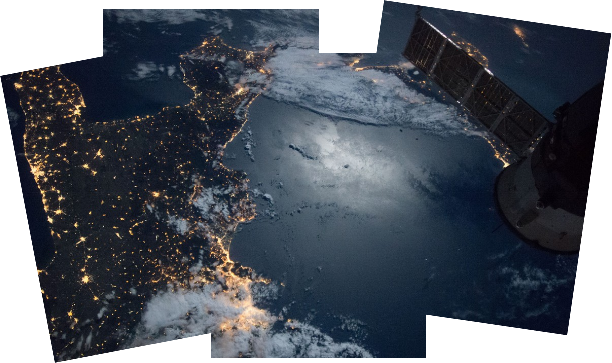
Satellite constellation equipped with ultra-high resolution optical-electronic sensors for remote sensing.
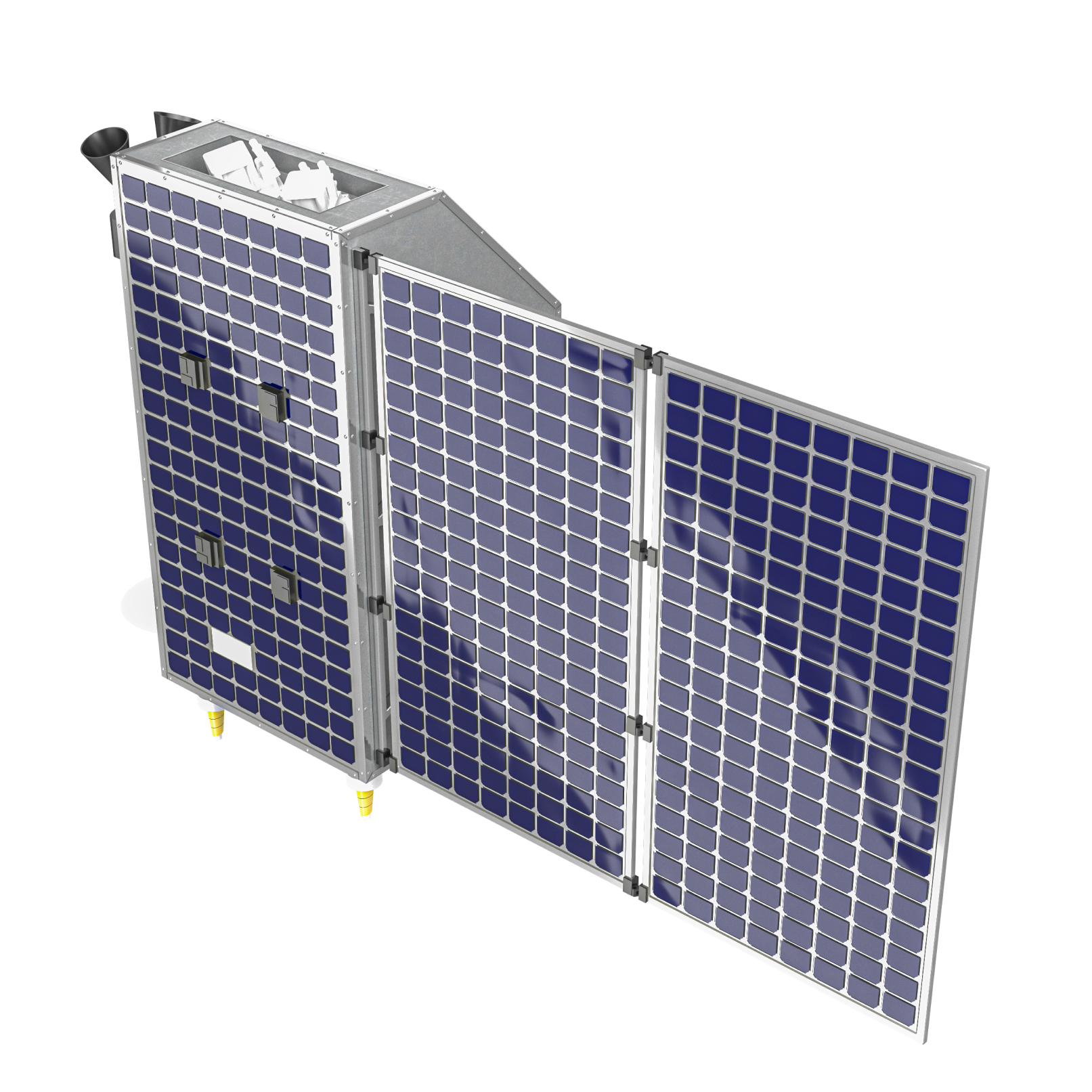
This constellation will include 12 small satellites, each of which will carry an optical-electronic camera for highly detailed space imaging with a resolution of 0.5 m, and an imaging infrared spectrometer
This constellation will include 12 small satellites, each of which will carry an optical-electronic camera for highly detailed space imaging with a resolution of 0.5 m, and an imaging infrared spectrometer
SR oko


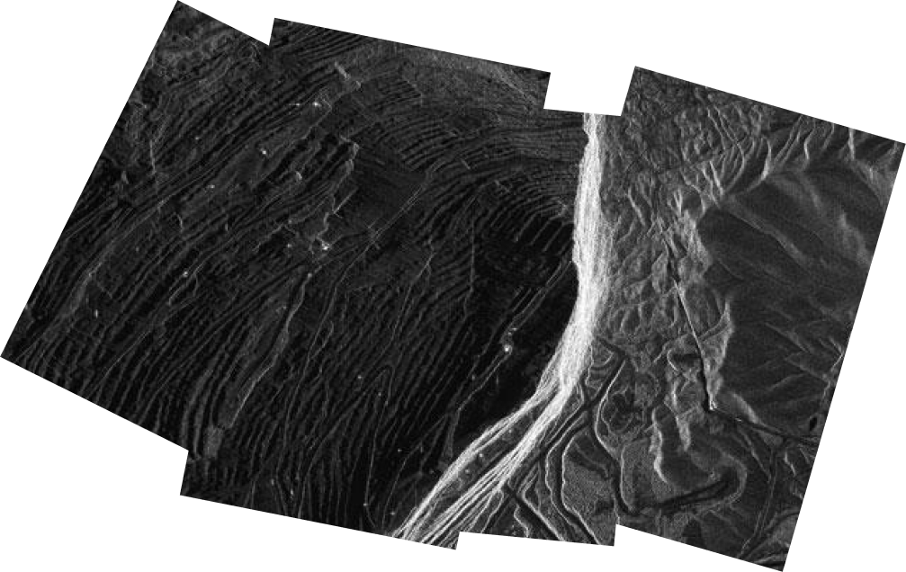
SR SAR technologies are based on scanning and modeling the landscape using a radio signal reflected from the Earth. SAR imagery includes information about the phase and polarization of the reflected electromagnetic wave. That provides new opportunities for Earth observation compared with the usage of optical satellite systems.
Our satellite constellation will include 12 small satellites, which will allow not only to observe the entire Northern Sea Route with revisit time of less than 3 hours, but also to provide continuous radar monitoring services around the world
Our satellite constellation will include 12 small satellites, which will allow not only to observe the entire Northern Sea Route with revisit time of less than 3 hours, but also to provide continuous radar monitoring services around the world
SR sar
SR SAR satellite data is suitable for applications in the following areas:
- monitoring of floods and ice cover;
- detection and control of water pollution;
- crop assessment and forest monitoring;
- mapping and inventory of land use;
- control and inform people during natural disasters and emergency situations.
- monitoring of floods and ice cover;
- detection and control of water pollution;
- crop assessment and forest monitoring;
- mapping and inventory of land use;
- control and inform people during natural disasters and emergency situations.
Operating frequency range
Signal bandwidth
3 100…3 300 MHz
200 MHz
Spatial resolution of the target equipment in detailed mode
1,2…2,0 m
SAR antenna size
Frame size / path length, (azimuth × range)
detailed
detailed
4,5×1,2×0,15 m
detailed
15×15 km
route
50×50…80/1 350 km
Satellite mass
≤350 kg
Lifetime of active work
5 years
survey
200×320…350/1 350 km
Radar sensing


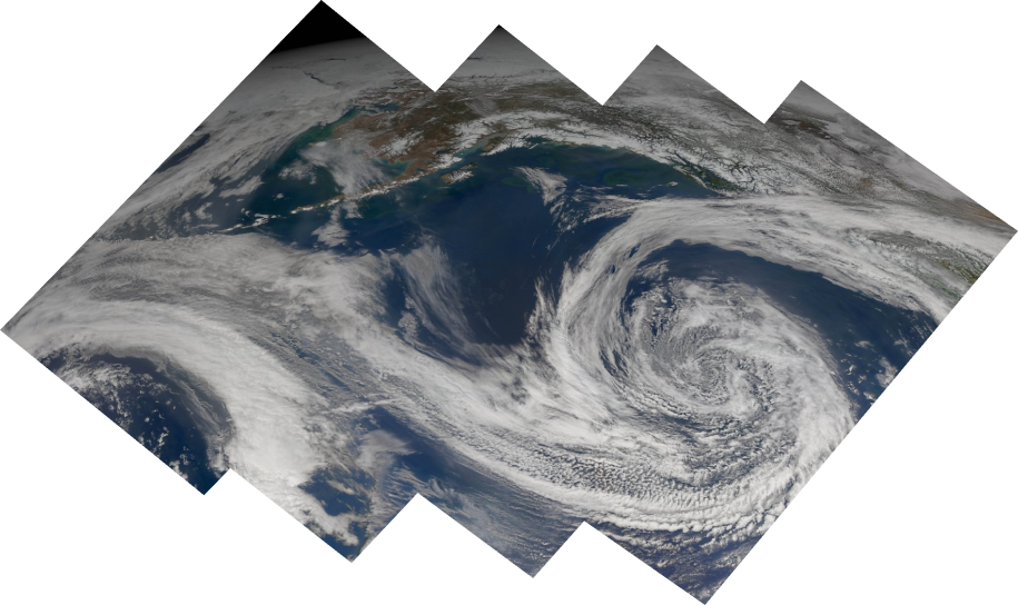
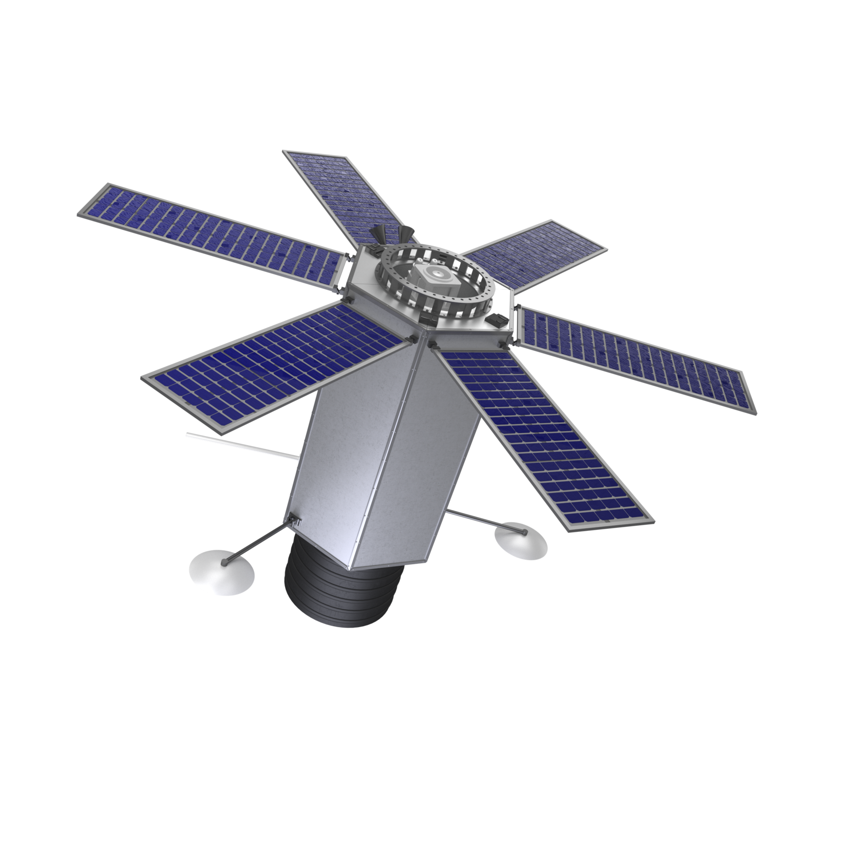
The commissioning of SR CMS, based on the measurement of greenhouse gas concentrations and fluxes using infrared spectrometry methods, will allow you to quickly monitor, evaluate and identify sources of emissions and sinks of both natural and anthropogenic greenhouse gasses, areas of emission and absorption.
There are 3 main components of SR CMS: space infrastructure, ground infrastructure, software and hardware systems. SR CMS will include 60 small spacecrafts, 2 ground stations, 100 fixed and mobile ground stations.
There are 3 main components of SR CMS: space infrastructure, ground infrastructure, software and hardware systems. SR CMS will include 60 small spacecrafts, 2 ground stations, 100 fixed and mobile ground stations.
SR sms
Swath width at the orbit altitude 600 km
≥400 km
Spatial resolution
spectral channel 945–2 203 nm
5 m
spectral channel 3 300–6 500 nm
500 m
Data flow
≤200 Mb/s
Weignt
≤100 kg
spectral channel 10 200 nm
35 m
Greenhouse gas monitoring

SR CMS will allow solving urgent scientific and technical problems for various sectors of the economy:
- carry out continuous monitoring of greenhouse gas emissions from the main emission facilities: pipelines, industrial enterprises, fields, logistics hubs;
- carry out monitoring a specific object, region or an entire country;
- assess the amount of environmental and economic damage from the emissions;
- assess the absorption capacity of natural ecosystems (forests, swamps, etc.);
- measure the surface temperature of the seas and oceans;
- measure the temperature of the underlying surface;
- to determine the wind speed and moisture level in the atmosphere.
spectral channel 7 700–11 200 nm
1 000 m
Design life
5 years
Parameters of possible work orbits: altitude ranges of the work orbits, km
Parameters of possible work orbits: altitude ranges of the work orbits, km
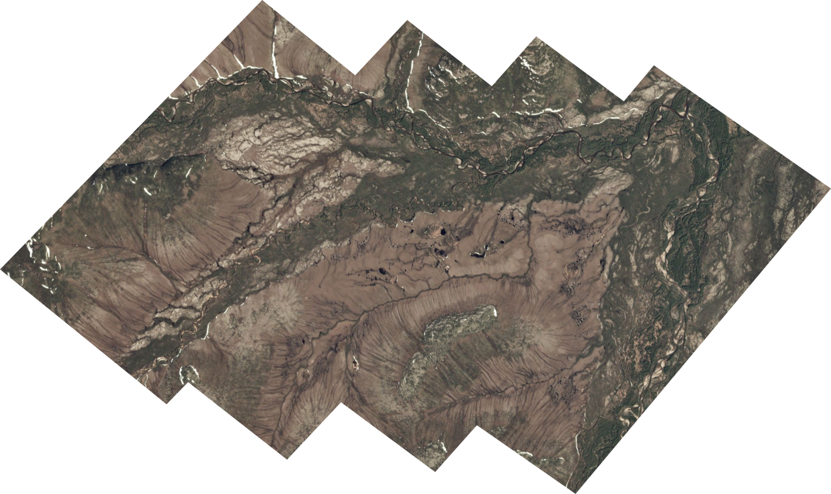
Ultra-high resolution imagery is used to satisfy various needs of society: nature management, cartography, solving problems of agriculture and forestry, emergency prevention and control, inventory and monitoring of the state of transport, energy and information communications
SR oko
Visualization mode
along the flight path
Projection of a pixel to nadir for an altitude of 600 km
0,5 m
The swath for an altitude of 600 km
18 km
Optical monitoring
In addition to direct high-detail photography of the entire planet surface, SR OKO will provide the following services:
- determination of the type of vegetation and soils;
- determination of the area, temperature and intensity of fires;
- measurement of the leaf cover index;
- determination of the boundaries of ice and snow cover.
- determination of the type of vegetation and soils;
- determination of the area, temperature and intensity of fires;
- measurement of the leaf cover index;
- determination of the boundaries of ice and snow cover.
Spectral channels
Р + R + G + B + NIR

Optical system modulation transfer function (MTF)
P≥0,1, MS>0,2
Spacecraft mass
≤150 kg
Lifetime of active work
5 years
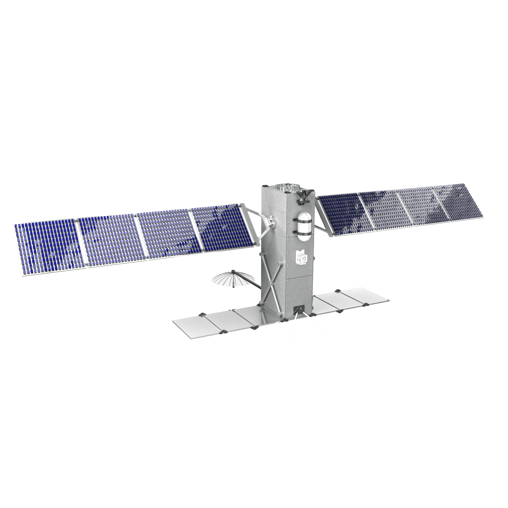
Within the framework of commercial cooperation agreements, SR Space is developing spacecraft for optoelectronic remote sensing of the Earth with high and ultra-high resolution: SR OKO-1, SR OKO-2, SR OKO-3.
SR OKO-1
OKO specs
Parameter value
Working spectral range, µm
0,4-0,7
Spatial resolution, m
4
Swath width (nadir), km
16
Parameters of possible work orbits: altitude ranges of the work orbits, km
400
Power supply system, W
25
Manufacturing time, years
1
Design life, years
1
Spacecraft dimensions, mm
340х100х100
Weight, kg
4,5
SR OKO-2
OKO specs
Parameter value
Working spectral range, µm
0,42-0,7
Spatial resolution, m
panchromatic
2
multispectral
6
Swath width (nadir), km
15,8
Coverage width (with retargeting), km
350
Power supply system, W
80
Manufacturing time, years
1,5
400-550
Design life, years
3
Spacecraft dimensions, mm
454х226х226
Weight, kg
31
SR OKO-3
OKO specs
Parameter value
Working spectral range, µm
0,45-0,7
Spatial resolution, m
panchromatic
0,9
multispectral
3,4
Swath width (nadir), km
12,8
Coverage width (with retargeting), km
350
Power supply system, W
230
Manufacturing time, years
2
400-550
Design life, years
5
Spacecraft dimensions, mm
880х930х970
Weight, kg
70
SR oko
Parameter
Working spectral range, µm
0,4-0,7
Spatial resolution, m
Swath width (nadir), km
Coverage width (with retargeting), km
Parameters of possible work orbits: altitude ranges of the work orbits, km
Power supply system, W
SR OКO-1
SR OКO-2
SR OКO-3
0,42-0,7
0,45-0,7
- panchromatic
- multispectral
4,5
1,5-2
0,9-1,2
-
6
3,4
16
15,8
12,8
-
350
350
500-600
500-600
500-600
25
120
230
Manufacturing time, years
1
1,5
2
Design life, years
1
4
5
Spacecraft dimensions, mm
340х100х100
454х226х226
880х930х1500
Weight, kg
4,5
23
70
Ultra-high resolution imagery is used to satisfy various needs of society: nature management, cartography, solving problems of agriculture and forestry, emergency prevention and control, inventory and monitoring of the state of transport, energy and information communications
Visualization mode
along the flight path
Projection of a pixel to nadir for an altitude of 600 km
0,5 m
The swath for an altitude of 600 km
18 km
Optical monitoring
In addition to direct high-detail photography of the entire planet surface, SR OKO will provide the following services:
- determination of the type of vegetation and soils;
- determination of the area, temperature and intensity of fires;
- measurement of the leaf cover index;
- determination of the boundaries of ice and snow cover.
- determination of the type of vegetation and soils;
- determination of the area, temperature and intensity of fires;
- measurement of the leaf cover index;
- determination of the boundaries of ice and snow cover.
Spectral channels
Р + R + G + B + NIR
Optical system modulation transfer function (MTF)
P≥0,1, MS>0,2
Spacecraft mass
≤150 kg
Lifetime of active work
5 years
Within the framework of commercial cooperation agreements, SR Space is developing spacecraft for optoelectronic remote sensing of the Earth with high and ultra-high resolution: SR OKO-1, SR OKO-2, SR OKO-3.
The development of a space system of high-speed broadband Internet access is of particular importance for our country due to its geographical location, the distribution of natural resources and socio-economic infrastructure. That is a critical technology, being a basis for the economy built on Big Data: millions of unmanned vehicles and drones, hundreds of millions of CCTV cameras (street, corporate, technological), robotic systems that control tens of thousands of wells in real time.
The deployment of an orbital constellation of 672 spacecrafts will provide broadband Internet access in remote and hard-to-reach areas in Russia, including the Arctic zone.
The deployment of an orbital constellation of 672 spacecrafts will provide broadband Internet access in remote and hard-to-reach areas in Russia, including the Arctic zone.
SR net
Various organizations in the field of oil and gas production, geological exploration can become users of that satellite broadband communication system; monitoring services for air, sea, river and land transport, as well as telecom operators in remote and hard-to-reach areas of the country.
Total System Throughput
Number of ground stations
3,75 Tb/s
660 pcs
Number of teleports
150 pcs
Satellite mass
460 kg
Lifetime of active work
5 years
Satellite Internet


Get news from SR Space

© 2023. All rights reserved
Team contacts:
Media contacts:

